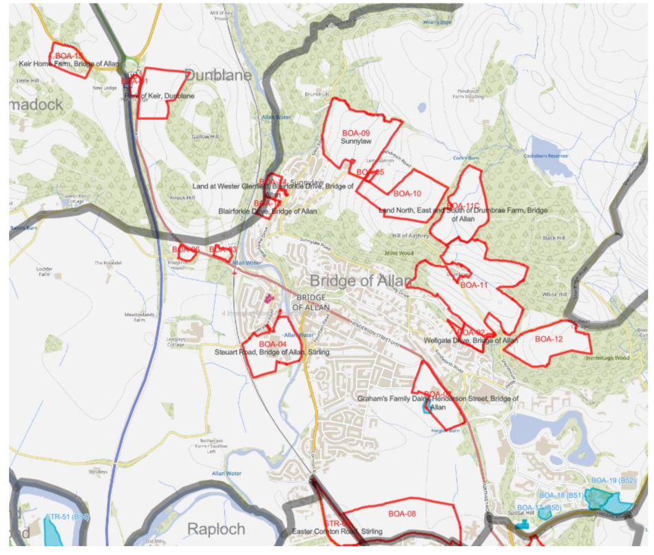
Stirling Council Planning Department have issued a document with all the Site Options for consideration in the next Local Development Plan which will become policy in 2028
Sites have been put forward by landowners and developers, if accepted into the LDP they would be quite likely to get planning consent if/when a planning application is submitted. The document has listed some constraints eg flooding, greenbelt, local landscape area. Transport, access and local facilities have not yet been assessed.
There will be a public drop in meeting, hosted by the planning department in Bridge of Allan at The Allan Centre on Wednesday 3rd June 13:00 – 18:00.
Comments can be submitted via Engage Stirling Site Options survey
The Bridge of Allan-Site Options Paper-April 2026.pdf paper can be downloaded from the above survey web page or from this link: Bridge of Allan Site Options Paper
This is an overview map of the sites (click here to zoom in: Bridge of Allan Sites)
Ba08- the density of 300 houses here would be not be in keeping with the local area particularly the green belt and would be devastating to that area. The local roads network currently cannot cope as has been shown recently and is already a significant challenge to residents, this would simply further compound that and present a safety risk by increasing significant congestion and compounded air pollution. This area is vital for flood management which already causes real challenge in the area with register and significant flooding
BA04 – this is directly adjacent to the Allan water and in particular a critical salmon lie . The river already suffers real pollution and challenges to its salmon stock. Building here would have major impact on the drainage and water management if that land and impact massively on the flood run off areas into haws park. This area needs to remain clear to support sustainability of this critical salmon river